Offline mapping for gold prospectors

Know exactly
where you’ve been.

Track your route, log every find, and explore historical gold records, geology, land use and 1-metre Bare Ground LiDAR-even without mobile reception. At the end of the day, GPS points you straight back to where you started. Your data stays on your phone.

Launch sale Yearly Prospector Subscription $46.99 first year, not $69.99 · ends October 2027

Now on the App Store and Google Play

Download on the App StoreGet it on Google Play
Garmin watch? Get it from the Connect IQ Store →

01Research before you go

Do the homework on a big screen

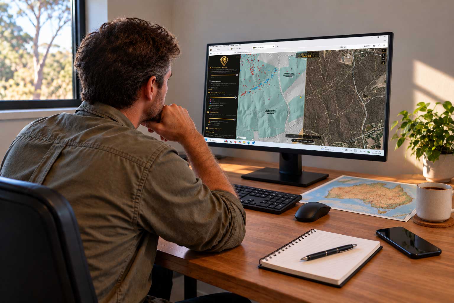
The Web Map Viewer puts every layer the app has on your desk: 1-metre Bare Ground LiDAR, the old workings, historical gold, geology and land access, state by state. Find the ground worth walking, mark it, then take the phone.

A prospector at a desk studying the Prospector Mate Web Map Viewer on a monitor, LiDAR relief and mining features on the left, satellite imagery on the right.

02Layers, state by state

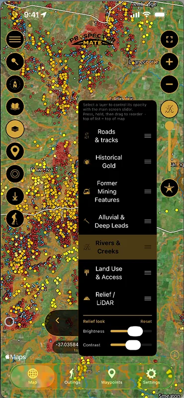
Display the layers you need on the map

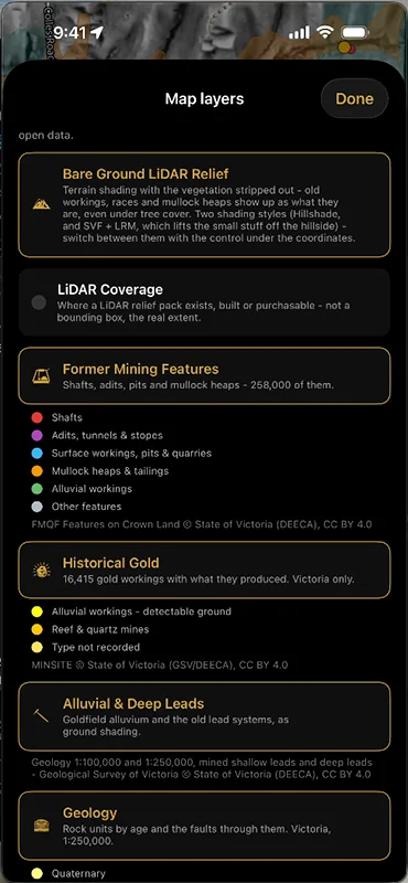
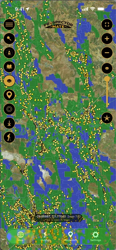
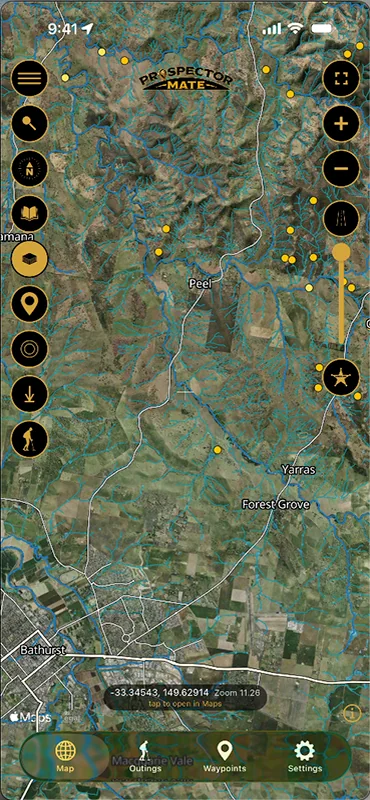
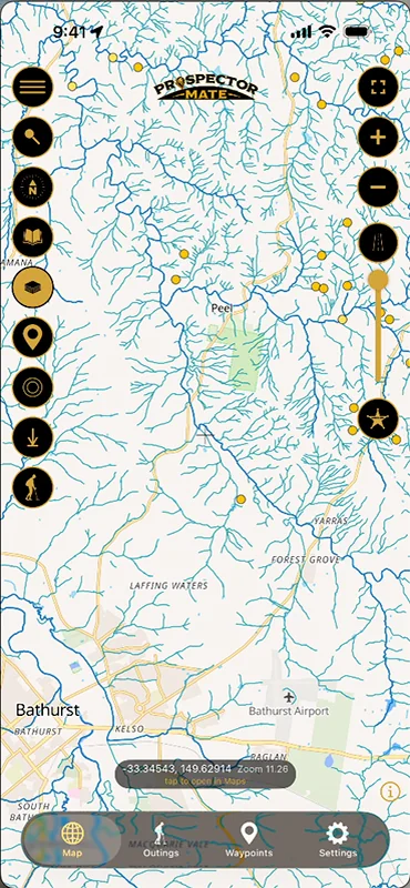
Historical gold, the old workings, alluvial and deep leads, geology, geochemistry, land use and access, rivers and creeks - each state’s own registers, drawn the way a prospector reads them, with Bare Ground LiDAR underneath. Tap a dot for its record, drag the layers into the order you want, fade any of them. Many more layers are on the way.

03Works with no reception

Take the map bush with you

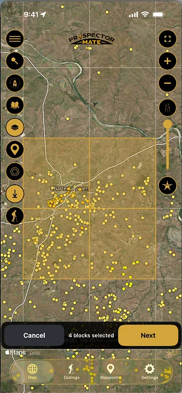
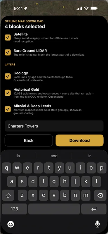
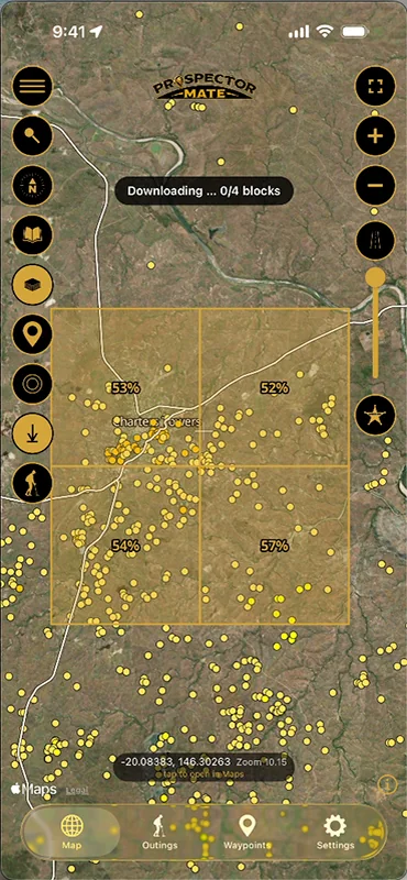
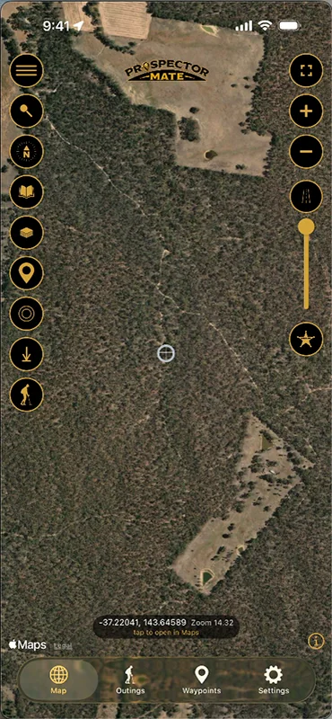
Pick the blocks you want, tick the layers - satellite, Bare Ground LiDAR, geology, historical gold - and download them while you still have signal. Out past reception the map, the layers and your position all keep working: the GPS comes from the phone’s own chip, not from data.

04Outings

Every step of the day, and every find

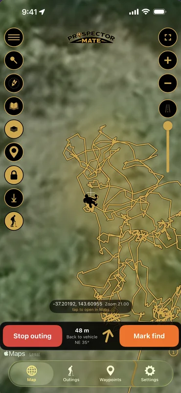
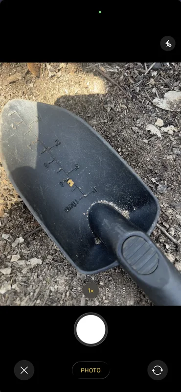
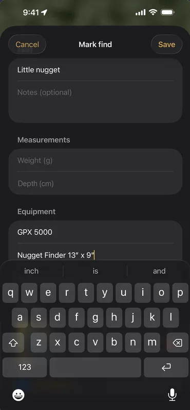
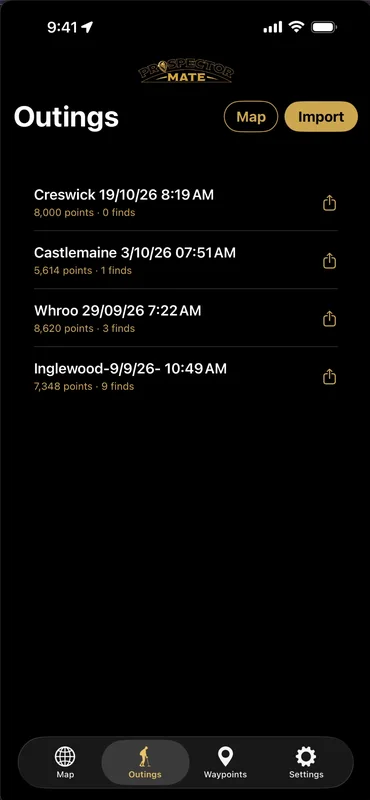
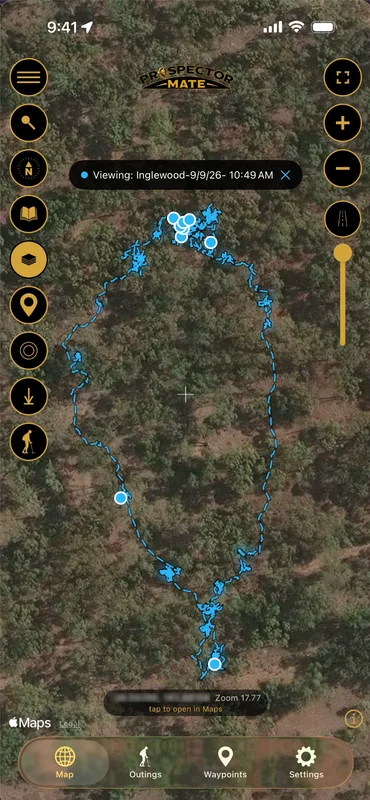
Start an outing and the phone draws your track as you swing - screen off, phone in your pocket, no reception needed - with the distance and direction back to the vehicle always on screen. Dig a nugget and mark it where it came out of the ground: a name, a photo, the weight, the detector and coil that found it. It all stays on your phone.

05Replay and reload

Walk the day again

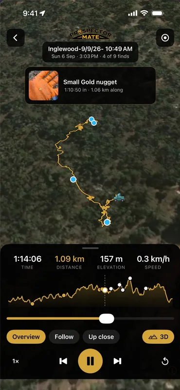
Every outing is kept on your phone. Replay one on its own map and watch the track draw itself again, with the time, distance, elevation and speed as you go, and each find popping up with its photo where you dug it. Record the replay as a video to share. Or load an old outing onto the map and walk it again, or work the ground you missed.

06Western Australia

Who holds the ground

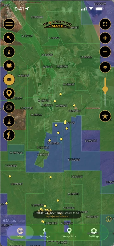
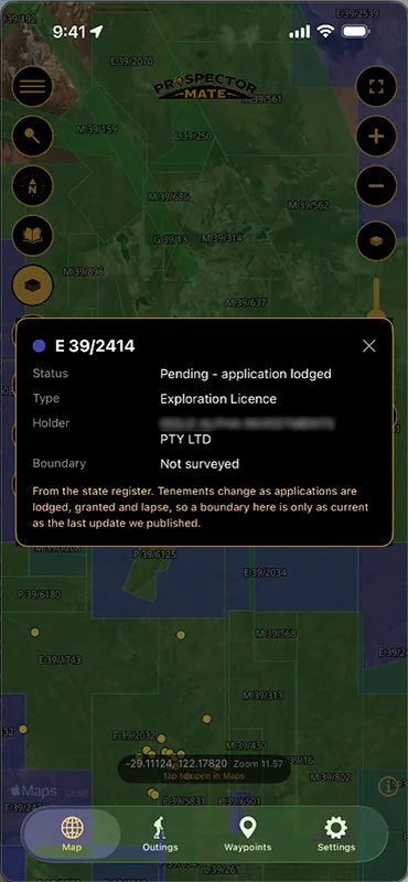
Every live and pending tenement in WA from the state register, refreshed every morning before sunrise, drawn as the real boundaries with the tenement number on the map - crisp however far you zoom. Tap one for its status, type and holder. Turn them solid to read the field, or fade them back over the imagery underneath.

07Waypoints

Mark it, name it, find it again

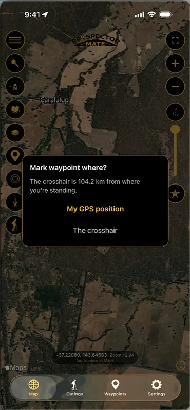
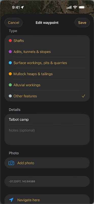
Drop a waypoint where you stand or under the crosshair - a shaft, a camp, the car, ground you want to come back to. Give it a type, a name, a note and a photo, and on the day navigate straight back to it. Waypoints stay on your phone unless you choose to export them.

08Three base maps

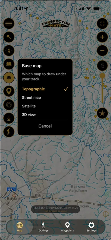
Satellite, street or topo

Choose the map under your track: satellite imagery to read the ground, a street map for getting there, or the topographic map with its contours - and tilt any of them into 3D. All three download for offline use, so the choice is still yours out past reception.

09The extras

Weather, gold price and the manual

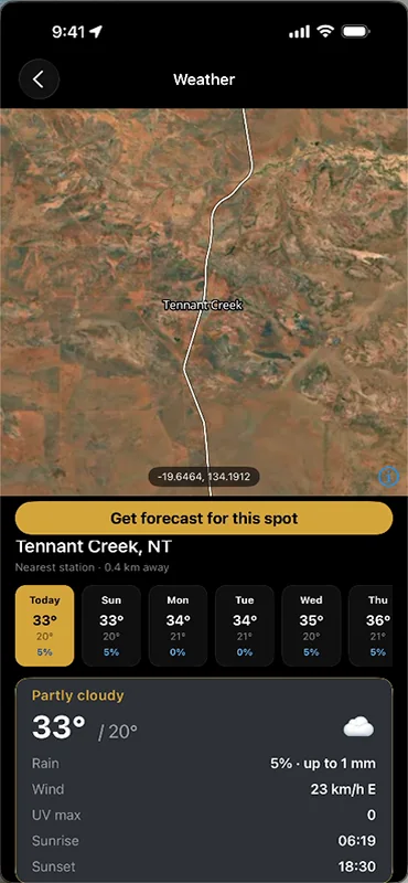
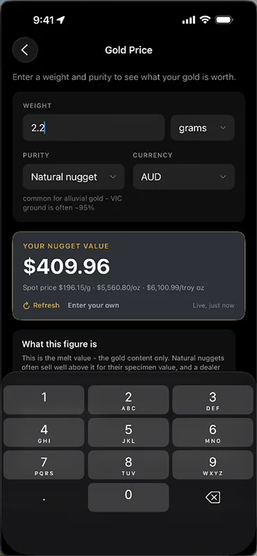
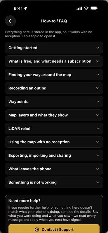
A seven-day forecast for any spot on the map, from the nearest station. A gold price calculator that turns a nugget’s weight and purity into what it is worth at today’s spot price. And a how-to guide kept inside the app, so it reads with no reception. Small things, on the phone already in your pocket.

Built for the bush, not the boardroom

Tracks you with no reception

Your position comes from the phone’s GNSS chip, not from data. Walk out of range, keep recording - screen off, in your pocket, all day.

Mark a find in seconds

Photo, weight, depth, and the detector and coil you were swinging when you got it. Dropped on the map where you stood.

Bare Ground LiDAR

1-metre laser survey of the goldfields with the vegetation stripped out, so old workings, races and mullock heaps show up as what they are - even under tree cover.

Finds the way back

Live distance and bearing to where you started - the vehicle, camp, or the edge of town - with an arrow that turns as you do. Or load a past outing onto the map and walk back to the patch that paid off last time.

Bring your data with you

Import your tracks and spots from Detector Maps, Trilobite or any GPX, KML, KMZ or CSV file - free. And your own data is never locked in: export to GPX, KML, PDF or CSV whenever you like.

Own a smartwatch? It can come along too

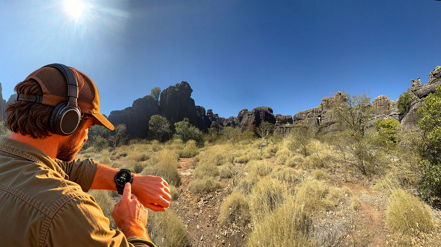
Optional. Everything works on your phone alone. If you already wear an Apple Watch, a Wear OS watch or a Garmin, Prospector Mate can also show the way back on your wrist - so the phone can stay in your pocket.

A prospector in a cap and detector headphones checking the way back on his watch, with spinifex and dark rock ranges in Western Australia behind him.

The way back, on your wrist

An arrow and the distance to where you started - the car, the camp, the edge of town. Turn until the arrow points ahead, and walk.

The day so far

Distance walked, time out and finds marked, updating as you go. It tells you when you are back at your start.

The phone stays in your pocket

The phone does the recording, screen off, with no reception. The watch shows what it records - nothing extra is collected or sent anywhere.

Apple Watch

With iPhone

Follows the outing on your iPhone. The arrow turns with the watch’s own compass, and the summary comes up on your wrist when you stop.

Wear OS

With Android

Samsung Galaxy Watch, Google Pixel Watch and the other Wear OS watches. Installs alongside the Android app from Google Play.

Garmin

With iPhone or Android

fēnix, epix, Enduro, Instinct, Forerunner, Venu, vívoactive, MARQ and more - close to a hundred models. From the Connect IQ store, through Garmin Connect - the watch offers to open the app when an outing starts.

Get it from the Connect IQ Store →

No watch? Nothing is missing - the phone shows all of this too. The watch apps are included in the Prospector Subscription.

Nothing leaves your phone unless you send it

Prospectors are a suspicious mob, and reasonably so - a photo shows the ground you were standing on. So your outings, tracks, finds and photos never leave the phone - except to your own iCloud Drive or Google Drive, if you choose the Backup option. Not to us, not to anyone else.

Your privacy matters to Prospector Mate. The app doesn't spy on you, profile you or report what you do - your outings are saved on your phone, for you, and nowhere else.

There is no sign-up. The app holds nothing about you unless you choose to give it - no payment details, no analytics, no ads, no trackers. Beyond that it talks to the network only to fetch map tiles, the weather and the gold price, and once you have downloaded an area it does not need the map tiles either.

When you export a day, you get a .pmate file you own. Anyone with Prospector Mate can open a normal one - handy for sharing with a mate or the club, and worth knowing before you send it on. If the location matters, export it with a code instead: the app generates the code, shows it once, and stores it nowhere. Nobody can open that file without it, including us.

Anything that leaves the phone leaves because you sent it - passed to a mate, copied to your own computer or a USB stick, or kept safe by the free Backup option, which writes to your own iCloud Drive or Google Drive and nowhere else, so a wrecked or lost phone does not take your outings with it.


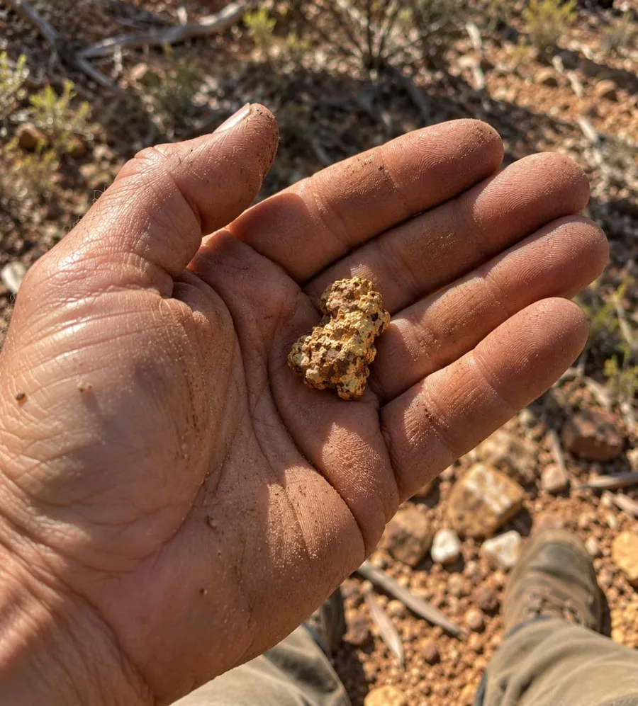
A prospector's dusty open hand holding a gold nugget, out on red goldfields ground.

Bare ground, to the metre

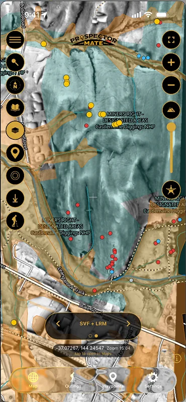
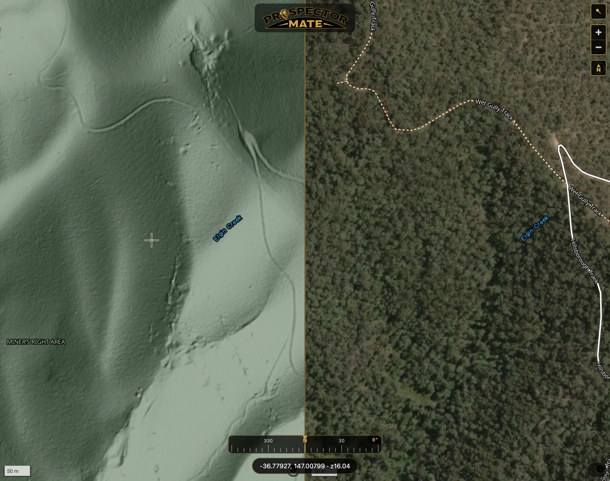
Bare Ground LiDAR is a 1-metre laser survey of the goldfields with the vegetation stripped out of it. That is the difference that matters: under tree cover that hides everything from the air, a costean looks like a costean and a mullock heap looks like a mullock heap.

There is no low-resolution version of this. A 30-metre model is enough to read a valley and no use at all for reading a working, so relief comes with the subscription or not at all. Queensland, New South Wales and Tasmania are live now, and it downloads for offline use like any other layer. Victoria is coming soon.

With Victoria’s LiDAR, you do not have to pay to find out whether it covers your patch. The LiDAR Coverage layer is free, and outlines exactly where 1-metre coverage exists, so you can check your ground against it first and add Victoria only if the answer is yes.

The Web Map Viewer split in two: Bare Ground LiDAR relief of a forested gully with old workings and races showing on the left, satellite imagery of the same ground, hidden under tree cover, on the right.
A screenshot of the Web Map Viewer in Side by Side View: Bare Ground LiDAR on the left, satellite of the same ground on the right.

What it costs

One subscription covers the app, every layer, and the Web Map Viewer. Victorian LiDAR is coming soon as the one add-on. All prices in Australian dollars.

Free$0No sign-up, no card, no end dateProspector SubscriptionYearly$46.99first year, then $69.99 a yearorMonthly$9.99a month
The map
Topographic, street and satellite maps, in 3D✓✓
Search for towns, places and coordinates✓✓
LiDAR Coverage - see where 1 m LiDAR exists✓✓
Prospecting Suppliers - detector shops and suppliers near you, with a Call button✓✓
Every map layer - historical gold, old workings, geology, land access, rivers, tenements, live fires–✓
Historical Sites - heritage-listed mining places in every state, with photos and the stories behind them–✓
Bare Ground LiDAR Relief - 1 m, for QLD, NSW and TAS–✓
Victorian LiDAR - add-on–Coming soon
Offline map downloads - every layer, satellite included–✓
In the field
Return to start - arrow and distance back to your vehicle or camp✓✓
Record outings - track, distance and time–✓
Mark finds with photos, weight, depth and the gear you used–✓
Mark waypoints and navigate to them–✓
Smartwatch - Apple Watch, Wear OS and GarminThe way backPlus your stats
Weather and the live gold price–✓
Your records
Open, replay and export what you have recorded - .pmate, GPX, KML, PDF, CSV✓✓
Import from Detector Maps, Trilobite, or any GPX, KML, KMZ or CSV file✓✓
Backup to your own iCloud Drive or Google Drive, or to a folder on your phone or computer - never to our servers✓✓
Lapse or cancel and your outings stay yours, forever✓✓
The Web Map Viewer on a big screen–Included

$46.99 is the launch price for your first year on the yearly plan, until October 2027. Monthly is $9.99 a month, cancel any time. In the App Store and Google Play now.

Download on the App StoreGet it on Google Play

Victorian LiDAR

Coming soon

Add-on to the Prospector Subscription, for Victoria only

  • 1-metre survey, vegetation stripped out
  • Works offline once downloaded
  • Check LiDAR Coverage free first - see if your ground is covered before you add it
  • Shows in the app and the Web Map Viewer

Web Map Viewer only

$19.99 a year

For a big screen without the app

  • Every layer and the QLD, NSW and TAS LiDAR, on a desk-sized map
  • Victorian LiDAR coming soon
  • Open a .pmate from your phone - read in the browser, never uploaded
  • Plan the trip, then take the phone
  • Included free with the Prospector Subscription - link the app to your account and there is nothing to buy
Available now

Cancelling or lapsing never locks you out of your own finds - every outing, photo and waypoint you have recorded stays readable on your phone.

Prospector Mate - offline maps for gold prospectors